Shaanxi Ireeda Protective Technology Co., Ltd.
Engineer Manager : Ms.Melin
WhatsApp: +8618291418396
E-mail: melin@ireeda.com
DA-MHT5-6 Multi-Spectral Imaging and Laser Ranging Device
Overview
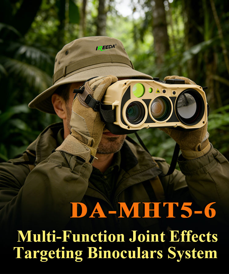
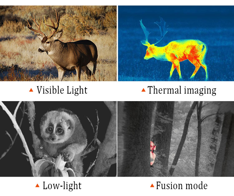
The DA-MHT5-6 is an integrated electro-opticalm observation device combining visible-light imaging, uncooled thermal imaging, low-light imaging, laser ranging, and multi-constellation positioning in a compact platform.
Designed for professional observation, field surveying, and outdoor data acquisition, the system features a 1920 × 1080 visible-light channel, a 640 × 512 uncooled thermal imaging channel, and an 800 × 600 low-light imaging channel. Its coaxial optical zoom system provides flexible observation across different viewing conditions.
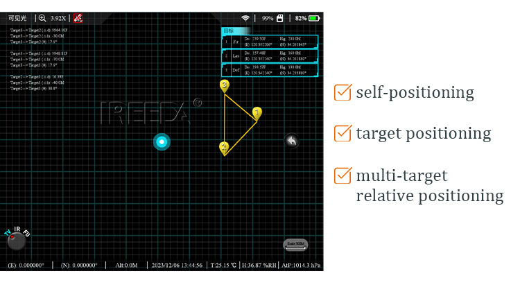
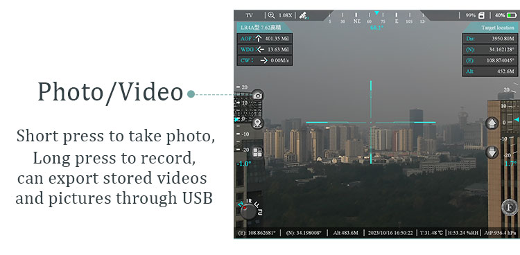
The integrated 1535 nm laser rangefinder offers a specified measurement range of at least 6 km for the stated visible-target conditions and at least 8 km for large buildings, with a listed measurement accuracy of ±1 m. A multi-constellation positioning module supports BeiDou, GPS, and GLONASS, while the digital electronic compass provides azimuth and pitch measurements.
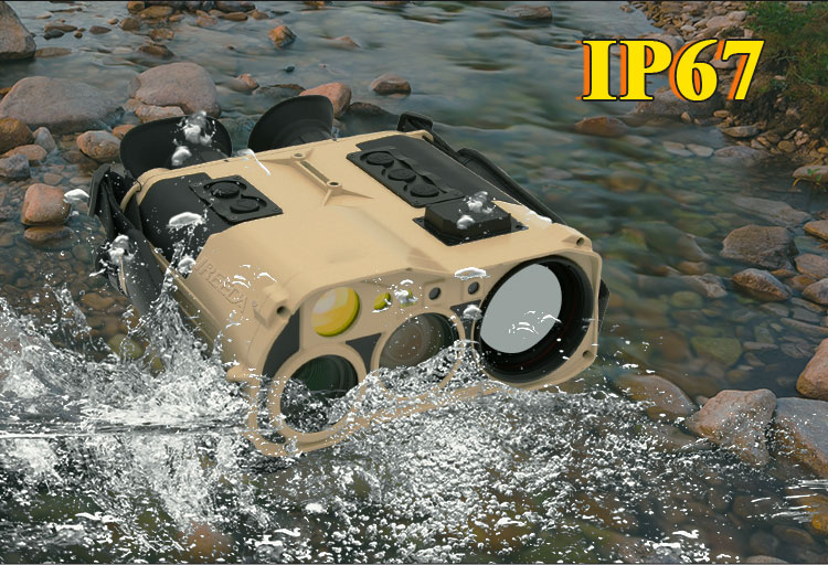
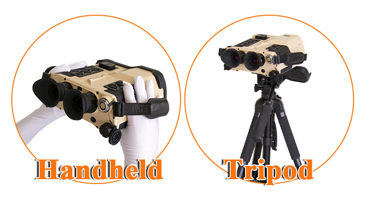
With an IP67-rated enclosure, a listed operating temperature range of −40°C to +60°C, and a weight of approximately 2.3 kg including the battery, the DA-MHT5-6 is designed for portable field operation.
Key Features
-
Three imaging channels: visible light, thermal imaging, and low-light imaging
-
1920 × 1080 visible-light resolution
-
640 × 512 uncooled thermal imaging resolution
-
800 × 600 low-light imaging resolution
-
Integrated 1535 nm laser rangefinder
-
Multi-constellation positioning: BeiDou, GPS, and GLONASS
-
Digital electronic compass with automatic magnetic-declination correction
-
1080P FHD OLED display
-
IP67-rated protection
-
Compact enclosure measuring 235 × 220 × 110 mm
-
Listed weight of approximately 2.3 kg, including battery
Specification
|
DA-MHT5-6 Multi-spectral Fusion Laser Target Detector Locator Binoculars
|
|||
|
Model Number
|
DA-MHT5-6
|
DA-MHT3-6
|
|
|
Visible Light
|
Resolution
|
High Resolution 1920*1080px
|
|
|
FOV
|
44°*34°~2.4°*1.8°(Coaxial optical zoom)
|
||
|
Working Illuminance
|
≥0.1Lx(Black and white)≥1.0Lx(Full color)
|
||
|
Recognition Distance
|
Personnel Targets≥3km Vehicle Targets:≥6km
|
||
|
Thermal Image
|
Resolution
|
Uncooled Thermal Imager 640*512px
|
|
|
Pixel Pitch
|
12μm
|
||
|
FOV
|
7.32°*5.86°
|
||
|
Recognition Distance
|
Personnel Targets:≥1km; Vehicle Targets:≥2km
|
||
|
Low Light
|
Resolution
|
800*600
|
/
|
|
Pixel Pitch
|
8µm
|
/
|
|
|
FOV
|
7.32°*5.86°
|
/
|
|
|
Laser Range Finder
|
Laser Wavelength
|
1535nm(human-eye safe class)
|
|
|
Measurement Range
|
≥6km(Vehicle); ≥8km(Large building)
|
||
|
Measurement Accuracye
|
±1m
|
||
|
Positioning Component
|
Positioning Mode
|
BeiDou/ GPS/ GLONASS Multi-mode
|
|
|
Coordinate System
|
Geodetic Coordinates:WGS84/CGCS2000
|
||
|
Projection coordinates:Gauss/MGRS
|
|||
|
Intelligent Automatic Correction of
Magnetic Declination |
Automatic identification of local magnetic declination (at the
specified location), eliminating the need for manual correction |
||
|
Electronic Compass
|
Azimuth Accuracy
|
0.5°(RMS)
|
|
|
Pitch Angle Accuracy
|
0.1°(RMS)
|
||
|
Laser Pointer
|
Invisible Laser
|
850nm 50mw
|
|
|
Visible Laser
|
520nm 30mw
|
||
|
System Performance
|
Display
|
1080P FHP OLED
|
|
|
Language Recognition
|
Quick Multi-functional Voice Recognition
|
||
|
Working Time
|
Continuous Working Time more than 9 hours
|
||
|
Start Time
|
Rapid startup less than 30s
|
||
|
Working Temperature
|
-40℃ ~ +60℃
|
||
|
Protection Level
|
IP67
|
||
|
Interface
|
Electrical Interface
|
USB/HDMI/DC/Pal/Laser Ranging Button
|
|
|
Physical Parameters
|
Physical Interface
|
NUC 1/4/Multi-functional Expansion Interface
|
|
|
Light Weight
|
2.3kg(with battery)
|
2.1kg(with battery)
|
|
|
Compact Size
|
235mm*220mm*110mm
|
235mm*205mm*85mm
|
|
Q 1: What imaging technologies does the DA-MHT5-6 support?
The DA-MHT5-6 integrates visible-light, uncooled thermal, and low-light imaging channels. According to the supplied specifications, the respective resolutions are 1920 × 1080 pixels, 640 × 512 pixels, and 800 × 600 pixels. Detailed imaging performance depends on the operating environment and configuration.
Q 2: What is the laser ranging capability of the DA-MHT5-6?
The supplied datasheet specifies a 1535 nm laser rangefinder with a measurement accuracy of ±1 m. The listed measurement ranges are at least 6 km under the stated visible-target conditions and at least 8 km for large buildings. Actual performance depends on target properties and environmental conditions.
Q 3: Which positioning systems does the DA-MHT5-6 support?
The specifications list BeiDou, GPS, and GLONASS multi-mode positioning, together with WGS84 and CGCS2000 coordinate systems. Gauss, UTM, and MGRS projection-coordinate options are also listed. Supported output formats and configuration details should be confirmed with the supplier.
Q 4: Is the DA-MHT5-6 suitable for outdoor operation?
The DA-MHT5-6 is specified with an IP67 protection rating and an operating temperature range of −40°C to +60°C. These specifications indicate a design intended for demanding outdoor environments, subject to the applicable test conditions and operating instructions.
Q 5: What are the dimensions, weight, and operating time of the DA-MHT5-6?
The listed dimensions are 235 × 220 × 110 mm, and the weight is approximately 2.3 kg including the battery. The supplied specifications state a continuous operating time of more than 9 hours and a startup time of less than 30 seconds. Actual operating time may vary with configuration and usage.
Contact us for the complete technical datasheet, available configurations, interface specifications, and application-specific compatibility information.
Request A quick Quote (WhatsApp/wechat:+86-18291418396)